Karuna Skariah, a National Board Certified Teacher, is an educator at Robert Goddard Montessori School in Prince George’s County Public Schools, Maryland. She is a mentor for teachers going through National Board Certification and has been in education for 19 years. She currently teaches a mixed group of 2nd-and 3rd-grade talented and gifted students.
Activity: Where on Earth: An Introduction to Latitude and Longitude
Grade Level: 2-3
Activity Length: Three 45-minute lessons
Subjects: physical science, geography, history, culture, reading language arts and mathematics
Tell us about your activity.

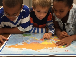
Students Rahsaan, Mason and Sara explore places on the world map.
Photo by Karuna Skariah
The goal of this activity is to teach students how latitude and longitude can help locate and identify a specific city or landmark on Earth. The acquired knowledge and skills from this unit help young students understand the human desire to explore the world around them.
With inspiration from National Geographic’s “Introduction to Latitude and Longitude” activity, students were first introduced to the concepts of latitude and longitude, and how intersecting lines (parallels and meridians) are expressed on maps. They learned that the intersection points of these lines are called coordinates.
I gave each student a world-map, printed from Nat Geo Ed’s 1-Page Map collection, to work out the coordinates of the White House. They had the opportunity to locate a favorite landmark (starting with the Taj Mahal), zoom in, and observe the structure of the landmark. The ultimate takeaway for my students was that lines of latitude and longitude connect us to places, cultures, climates, flora, and fauna.

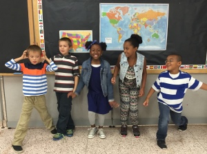
Students Mason, Braedon, Chayse, Sara and Rahsaan stand with the maps they used for their lesson.
Photo by Karuna Skariah
Following the Equator and other tropical lines of latitude gave them insight into rain forests, while the polar regions helped them understand the ice caps. Students were also fascinated by locating landmarks (natural and man-made) using coordinates. They were able to make concrete connections between the coordinates and how geotechnologies like GPS, satellites, Google Maps, and compasses communicate geospatial location.
How did this activity help students learn about the world?
In this lesson, my students became geologists, cartographers, explorers, scientists, and mathematicians. They used their critical-thinking skills to solve a particular problem related to geographic location; identify coordinates; and narrate a brief history of a landmark of their choice. This activity engaged their literacy and numeracy skills through map-reading.
During the initial introduction to coordinates, some of the younger 2nd-graders were having difficulty tracing the lines of latitude between the Equator and Tropic of Cancer. The 3rd-graders helped the 2nd-graders trace the parallels so the younger students were able to come up with the correct coordinates for the landmarks. The 3rd-graders were empowered to impart their knowledge and collaborate with their peers. Students took responsibility for their own learning by comparing places sharing the same lines of latitude. They also challenged each other to find the coordinates of capital cities and famous monuments in Europe and United States.
http://blog.education.nationalgeographic.com/2015/11/10/educator-spotlight-where-on-earth-an-introduction-to-latitude-and-longitude/


